Zion is the Navel of the World
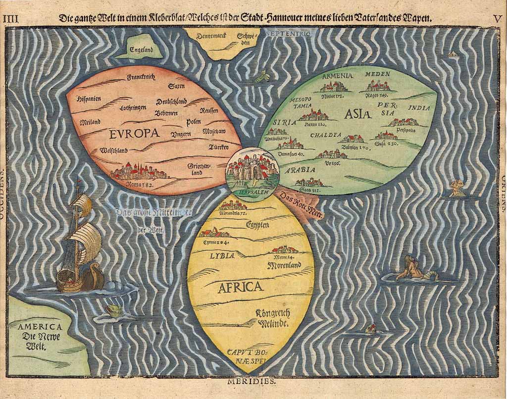
The Bünting Clover Leaf Map, also known as The World in a Cloverleaf, is a historic mappa mundi drawn by the German Protestant pastor, theologian, and cartographer Heinrich Bünting. The map was published in his book Itinerarium Sacrae Scripturae (Travel Book of Holy Scripture) in 1581.
Today the map is found within the Eran Laor maps collection in the National Library of Israel in Jerusalem. A mosaic model of the map is installed on the fence of Safra Square at the site of Jerusalem’s city hall.
The map is a figurative illustration, in the manner of the medieval mappa mundi format, depicting the world via a clover shape.[1] The shape symbolizes the Christian Trinity and also appears in the coat of arms of Hanover, where Bünting was born. The city of Jerusalem is represented as the centre, surrounded by three central continents, with some more areas of the world being accordingly illustrated separately from the clover.

Ebstorf Map
This is a reduced and retouched reproduction of the largest known medieval world map, made at or for the Benedictine abbey of Ebstorf in about 1235.
The original, measuring almost 12 feet in diameter, was destroyed in an air-raid on Hannover, Germany, during World War II. It was a classic mappamundi, a type of medieval world map or map-painting whose chief purpose was to teach Christian history to the faithful.
Such maps attempted to summarize and locate major events in religious and secular history and convey a wide variety of spiritual, ethical, and scholarly information including natural history, myth, and legend. They served as visual encyclopedias within a Christian framework set against a geographic backdrop; geographic accuracy was, accordingly, of secondary importance.
The author’s home territory was often disproportionately enlarged, and the size of other regions was dependent on their historical or religious importance and the amount of information to be inscribed on them.
These maps were commonly circular in shape with east at the top, although other geometric forms and orientations were used.
As noted earlier, Jerusalem was placed at the center of these large mappaemundi of the late Middle Ages. The religious purpose of the Ebstorf map is clearly evident: the world is depicted as the body of Christ. Christ’s head is at the top (east) adjacent to Paradise. His arms embrace the world and its people; even the monstrous races of Africa are gathered in and saved by His left hand.
Jerusalem is at the navel of the world, and is depicted as a square walled city enclosing an image of the risen Christ. A disproportionately large Middle East occupies the central portion of the map, with Asia above (east), Africa to the right (south), and Europe at the lower left (northwest). Places and episodes from the Old and New Testaments are prominently depicted.
In addition, contemporary geographic features including roads and scenic areas are portrayed, indicating that the map was designed to meet secular as well as religious needs of travelers.
Comment with GitHub
Newsletter
Navel Posts
-

New Nebraska Blackshirts Design Proposed
There is a fertility crisis brewing and the University of Nebraska is connected. The Blackshirts at UNL are the Blackshirts of history...
-

-
-
-
-

-

-

-
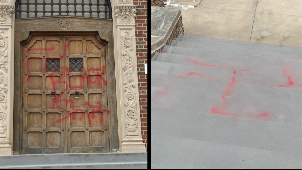
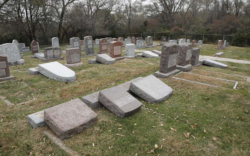
Lincoln Man Behind Bars for Blackshirts Synagogue Graffiti Says Jewish Man Paid Him
LINCOLN – A 22-year-old Lincoln man convicted of a hate crime for spray-painting swastikas and racial epithets on a Lincoln synagogue,...
-

-
-

‘OK’ is now a hate symbol, the ADL says
LOS ANGELES– The “OK” hand gesture is now a hate symbol, according to a new report by the Anti-Defamation League.
-

-

-

Rogue Planet Could Bring End Of Days This Weekend, Numerologists Say
SPACE – Here’s to hoping that you made plans for an epic weekend, because it may be our last.
-

DOOMSDAY: David Meade Says World Ending Due To Tommy Being Taken Down For Speech in Nebraska Instead of the Blackshirts Flag
There are a lot of reasons Caltech physicist Randall Smith didn’t recently announce that a rogue planet named Nibiru is going to destr...
Religion Posts
-
-
-
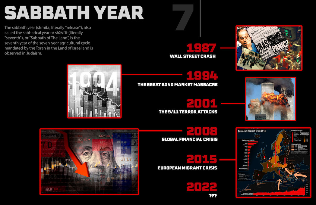
What Is The Sabbath Year?
Cycles of time are central to Jewish life. Just as Shabbat punctuates the week, so too the holidays punctuate the year.
-

-
-

-

-

Jewish Surnames Explained
Ashkenazic Jews were among the last Europeans to take family names. Some German-speaking Jews took last names as early as the 17th cen...
-
Latest Posts
-

-

-

-

Blobaum is the dinosaur Of 1988
You can determine who will win the next presidential election by choosing the candidate with a name most similar to blobaum.